

Surprisingly (or not), there are many other geocaching sites besides the main geocaching.com. These other sites have their own rules about placement, different rating and logging features, etc.
* NaviCache: one of the first alternatives to develop, based around looser restrictions
* TerraCaching: Developed with the desire of placing higher quality caches
* Opencaching (.us): A site promoting free use for all users, with no premium (paid) content.
* Opencaching.com: GPS manufacturer Garmin's geocaching website
I have a Terracaching account from a long time ago, when I was more active in geocaching. However, I never found or placed a terracache; there were none near me and I wasn't sure one of my caches would qualify as "high quality". Plus, I wanted people to actually find it. Terracaching isn't popular enough around here.
I do like Garmin's opencaching.com site layout. At first glance, I find it to be simple and intuitive. I think I still prefer geocaching.com, at least now that I'm familiar with how to navigate around the site (when I first started caching, that might be another thing...).
I also like the idea of Opencaching (opencaching.us), providing free caching without any special paid content. I generally like anything that's "open" for everyone to participate (open source software, wikis, etc.). The site is also fairly straight forward to use. I think I like its look a little more than opencaching.com.
There is confusion about opencaching.com and opencaching.us. At least, it seems potentially confusing. The .com is owned by Garmin. It's free, but I'm not sure what other features it has. It doesn't seem very clear to me what the goal or purpose of it is. On the other hand, the .us site has a more clearly defined aspect: keep it free. I understand why it exists as an alternative to geocaching.com. One convenient thing about it is the ability to cross-list caches, based on the few cache listing I've seen there. It makes it easy to say "Also listed on: Geocaching.com", with a link directly to that cache page.
One of the most common features that these alternative sites offer is rating caches. Geocaching.com, from what I understand, is against the idea of having ratings, per se. They did introduce a feature that allows premium members to mark their favorite 10% of cache finds. That's probably as close to rating as it'll get.
I don't know how I feel about rating. I love getting feedback from my caches - what I did good, what I need to work on, and so forth. The major downside I can see is different caching styles people have. That makes it difficult to compare user ratings equally, given that everyone will have different criteria. I guess most people view the good outweighing this for it to be a feature on many, if not most, of the alternatives.
08 May 2011

14 December 2009
Hercules, Hercules!
The title probably only makes sense if you've seen Disney's "Hercules." If you have, picture someone clapping their hands together as they say that. About a week ago, I finished The 12 Labors of Hercules series. There are 12 "labors," caches put on peaks in the area. These peaks are all challenging to get to. Some have trails, some don't. Many have portions of trail that offer false hope that they'll actually continue to the top. In each of the 12 caches, there's a code. When you have all 12 codes, you can find the 13th bonus cache.
So far, only four people have actually completed the series. I was the fourth. I had, at some point, thought I might actually be the first or second to finish. In 2007, I found nine of the caches in the series. I got caught up on the three tough ones: 9 - Anthony's Nose, 11 - Organ Needle, and especially 6 - Florida Peak (technically, I think it's an unnamed peak, but it's much easier to refer to it with a name).
I wrote up a brief summary in my 13th cache log of the entire series. I had to be very limited in what I wrote. I think it'd be kind of fun to re-examine the series a bit more in detail over the next few weeks (slowly, I'll add it over a few entries). That's my plan. I'm not sure if I'll remember to do it or not.
It was a very fun and challenging series that really opened my eyes up to hiking in more difficult terrain. I honestly hadn't put much thought into hiking up some of the peaks I did, or even doing much off trail stuff. With the encouragement that there was a cache on top of the peaks, however, I forced myself to go through some brutal stuff (especially on Anthony's Nose- yikes!).
So far, only four people have actually completed the series. I was the fourth. I had, at some point, thought I might actually be the first or second to finish. In 2007, I found nine of the caches in the series. I got caught up on the three tough ones: 9 - Anthony's Nose, 11 - Organ Needle, and especially 6 - Florida Peak (technically, I think it's an unnamed peak, but it's much easier to refer to it with a name).
I wrote up a brief summary in my 13th cache log of the entire series. I had to be very limited in what I wrote. I think it'd be kind of fun to re-examine the series a bit more in detail over the next few weeks (slowly, I'll add it over a few entries). That's my plan. I'm not sure if I'll remember to do it or not.
It was a very fun and challenging series that really opened my eyes up to hiking in more difficult terrain. I honestly hadn't put much thought into hiking up some of the peaks I did, or even doing much off trail stuff. With the encouragement that there was a cache on top of the peaks, however, I forced myself to go through some brutal stuff (especially on Anthony's Nose- yikes!).
29 November 2009
Yet another event?
It seems there's some pressure (insert mysterious eyes) for another event in Las Cruces sometime soon. I had been discussing with a few people about scheduling one for January. I had almost forgotten about it, until I saw I <3 Events, an Albuquerque event scheduled for February. It just hit me. A February event is already in the planning processes. It's even listed up at geocaching.com. I think it's time to finally start making the plans for an event down here.
I've hosted four events in the past (along with one CITO):
I've hosted four events in the past (along with one CITO):
- Pillage the Village... Inn was a "simple" restaurant meet and greet (okay, didn't quite turn out that way). I also included a little "quiz" for a contest to win coins and ammo cans. For my first event, I think it went very well.
- The Pride of Geocaching was held at a park at NMSU. It turned out great. The campus was empty (summer vacation), leaving the area ready to hide some caches.
- F is for Friends Having Fun was part of my on-going ABC's of Geocaching series (which I will finish one day). It was held on a BLM facility on A Mountain, and was a noon pot luck. I also ended up hiding nine caches specifically for the event.
- Another Aardvark Adventure Around the A was held at the same location as the last one, but was a slightly less organized potluck. It was more of a breakfast get together, with only a few caches. It still worked out great.
22 November 2009
Invasion of Roswell
I don't believe any aliens invaded Roswell, but I did! My dad and I visited last week for the Roswell That Ends Well event. It was a very fun event that had a slight twist on it. Most events tend to focus on finding caches. There are often games involved with finding the most, poker runs (where cards are placed at various caches- so you have to find more caches to get more cards, typically), etc. This event, however, focused more on the hiding aspect of geocaching. There were no prizes for those only finding caches. In that sense, finding the caches were the prizes. There were prizes for the best cache hide, however. There were some very good hides. Some were tricky, while others were simply hilarious and/or creative (but not necessarily difficult). The creativity of these hides really made the day fun. It was also pleasant not to worry about any contests. Sure, getting prizes at events is fun, but sometimes competition can make things stressful ("If we had only gone to that cache, we would have had another card..."). It can also be fun, though. This was a welcome change, though. I think hiders should be rewarded for their efforts.
Overall, the trip was very fun. It was a mixture of finding new caches (placed for the event) and existing caches. Altogether, my dad and I found 34 caches (18 on Saturday, 16 on Sunday as we drove home). We didn't see any aliens on this trip, however; I'm not sure if that's a good thing or something to be disappointed at.
Overall, the trip was very fun. It was a mixture of finding new caches (placed for the event) and existing caches. Altogether, my dad and I found 34 caches (18 on Saturday, 16 on Sunday as we drove home). We didn't see any aliens on this trip, however; I'm not sure if that's a good thing or something to be disappointed at.
05 November 2009
Got GPS?
I don't. Anymore. I managed to lose my GPS while attempting to find Big Windy Canyon. After a bit of hiking, I started feeling not so great. My nose was runny. I was moving at an incredibly slow rate. It was slow enough of a pace that I had doubts about getting up there and back before nightfall. It just wasn't a good hiking day. I did the sensible thing and turned around. Before I did that, I decided to climb up to the nearby hill for a scenic break. I could get lunch, call up a friend to hangout with after I got done, and just relax. It was relaxing. No, this isn't where I lost my GPS unit- I just really enjoyed the break.
I continued my hike down. I checked on my GPS unit once in a while. Soon, my friend calls me back. I tell her I found a good-ish path down avoiding a lot of the vegetation, and am actually making good time down (considering how long it took me to get to that point). I whipped out my GPS unit. 0.28 miles from the last cache I found (which was on my way back to the trail). I continued hiking.
About 10 minutes later, I wanted to get another reading, since I knew I was going at a nice pace. "I'll just turn on me GPS unit and--- Ah! I don't have my GPS unit!" I had no idea what happened to it. I followed my path back as best I could. For one part, that wasn't too bad- small canyon with only a few places to walk. I saw nothing. Then I get up out of the canyon. Oh. I have NO idea how I came down from the hill through this area about 2-3 acres that's full of boulders and dense vegetation in spots. I looked around in the smaller canyon for about an hour, but my nose was bothering me too much.
The next day, I hike out there again. I spend 4 hours looking around. It's not an easy thing, considering I'm not sure of the path I took. I can't do a thorough grid search because of the vegetation. The only way to find it is to walk around, going through areas that are more likely to have been used by me to walk through the day before. Oh, and my GPS unit is gray and black.
This will make geocaching a bit difficult until I can get a new one, but Christmas is coming soon. I wonder what will be at the top of my list?
I continued my hike down. I checked on my GPS unit once in a while. Soon, my friend calls me back. I tell her I found a good-ish path down avoiding a lot of the vegetation, and am actually making good time down (considering how long it took me to get to that point). I whipped out my GPS unit. 0.28 miles from the last cache I found (which was on my way back to the trail). I continued hiking.
About 10 minutes later, I wanted to get another reading, since I knew I was going at a nice pace. "I'll just turn on me GPS unit and--- Ah! I don't have my GPS unit!" I had no idea what happened to it. I followed my path back as best I could. For one part, that wasn't too bad- small canyon with only a few places to walk. I saw nothing. Then I get up out of the canyon. Oh. I have NO idea how I came down from the hill through this area about 2-3 acres that's full of boulders and dense vegetation in spots. I looked around in the smaller canyon for about an hour, but my nose was bothering me too much.
The next day, I hike out there again. I spend 4 hours looking around. It's not an easy thing, considering I'm not sure of the path I took. I can't do a thorough grid search because of the vegetation. The only way to find it is to walk around, going through areas that are more likely to have been used by me to walk through the day before. Oh, and my GPS unit is gray and black.
This will make geocaching a bit difficult until I can get a new one, but Christmas is coming soon. I wonder what will be at the top of my list?
03 November 2009
Calendar of Events
This is a calendar I update regularly with Google Calendar showing the events in New Mexico, since the main Geocaching event calendar makes it difficult to find the New Mexico caches. This also really helps in my personal planning because I can see that in two weeks on my calendar is an event. Sorry it's so small, but the layout of this blog doesn't allow much space. If you use Google Calendar, you can click the +GoogleCalendar button at the bottom to add it to your own calendar to watch- and it'll show up bigger. It will automatically update when I make changes to the calendar.
Alternatively, you can click here for a full-screen version of this calendar.
Alternatively, you can click here for a full-screen version of this calendar.
42nd Cache Hide
At the beginning of September, I hid my 42nd cache. When I realized what number cache hide it'd be, I thought I should do something special. What better than to have a Hitchhiker's Guide to the Galaxy themed cache? Originally, my plan was to have every question in the puzzle be 42 (hence, the "Part A"). I also had thought about getting the coordinates to match up with 42 as much as I could. Those didn't fully work out like I had wanted, so I settled for asking questions you'd need the book in order to answer. You might be able to find the answers by searching online. Actually, that'd probably be easier than looking through the book. I hope I rated the difficulty/terrain of the cache right.
The Hitchhiker's Guide to the Galaxy is a great book series (most of my questions only come from the first two, I believe). I've read slightly more than 3 of the five. I might have actually gotten most of the way through the 4th, but stopped reading for some reason. The other series in the puzzle (question 12) is also good, but a bit more off (and with an ending in the first book that almost ruined everything leading up to that point). Either series would be good to take if you find yourself stuck in a car for a few hours en route to a caching event.
The Hitchhiker's Guide to the Galaxy is a great book series (most of my questions only come from the first two, I believe). I've read slightly more than 3 of the five. I might have actually gotten most of the way through the 4th, but stopped reading for some reason. The other series in the puzzle (question 12) is also good, but a bit more off (and with an ending in the first book that almost ruined everything leading up to that point). Either series would be good to take if you find yourself stuck in a car for a few hours en route to a caching event.
02 November 2009
Someone's watching me
As if dropping myself off into a cache isn't strange enough, to allow for people to "discover" me, now someone is watching me. I guess that's what happens when you make yourself a travel bug. So far, no one has tried to "grab" me or stuff me into a cache. Even though I'm a small person, I don't know how many caches I'd fit into.
29 August 2009
The Matrix
There are a few challenge caches in the area that, should I choose to attempt the challenge, might impact what caches I look for. The two big culprits are the New Mexico Fizzy Challenge and 100,000 Foot Challenge.
The Fizzy Challenge requires me to fill out t he caching matrix: find one of every difficulty/terrain combination. As it turns out, there are 81 possible combinations (leading to a name I prefer: Tequila: 81 Proof [note: the owner's username is Tequila]). I still have quite a bit of work in the matrix to do. In the right is my current matrix (accurate at 668 caches - around August 8, 2009). Everything in red is what I still need to complete. The thing I'm really lacking in is the 4.5 and 5 terrain (of almost any difficulty). This does make me want to go on some longer, tougher hikes (especially to finish up the 12 Labors of Hercules cache series. The last one in the series for me would fulfill another requirement (3 difficulty, 5 terrain). Plus, it would allow me to find the final cache, a 5/5 rating. It's just a little added encouragement for me to try that cache again, although doing that cache alone is worthy enough.
The 100,000 Foot Challenge also encourages doing harder terrain caches, particularly ones where I'd gain a lot of elevation. The whole point of this challenge is to get 100,000 feet of net elevation gain while hiking on cache finds. Sadly, from what I've added so far, I'm not even quite at half. I still have quite a few caches I'm sure I could add in, but I probably have most of my "big hikes" listed. This really does encourage me to find hikes that I'd gain multiple thousands of feet in. Of course, most of these hikes already are very enjoyable and are usually in great spots to begin with. This is just a little nudge reminding me I haven't done as many as I'd like. I'll keep adding to it, though.
The Fizzy Challenge requires me to fill out t
he caching matrix: find one of every difficulty/terrain combination. As it turns out, there are 81 possible combinations (leading to a name I prefer: Tequila: 81 Proof [note: the owner's username is Tequila]). I still have quite a bit of work in the matrix to do. In the right is my current matrix (accurate at 668 caches - around August 8, 2009). Everything in red is what I still need to complete. The thing I'm really lacking in is the 4.5 and 5 terrain (of almost any difficulty). This does make me want to go on some longer, tougher hikes (especially to finish up the 12 Labors of Hercules cache series. The last one in the series for me would fulfill another requirement (3 difficulty, 5 terrain). Plus, it would allow me to find the final cache, a 5/5 rating. It's just a little added encouragement for me to try that cache again, although doing that cache alone is worthy enough.The 100,000 Foot Challenge also encourages doing harder terrain caches, particularly ones where I'd gain a lot of elevation. The whole point of this challenge is to get 100,000 feet of net elevation gain while hiking on cache finds. Sadly, from what I've added so far, I'm not even quite at half. I still have quite a few caches I'm sure I could add in, but I probably have most of my "big hikes" listed. This really does encourage me to find hikes that I'd gain multiple thousands of feet in. Of course, most of these hikes already are very enjoyable and are usually in great spots to begin with. This is just a little nudge reminding me I haven't done as many as I'd like. I'll keep adding to it, though.
10 August 2009
Caching without a car
...or truck, motorcycle, or any kind of auto-mobile.
I ended up selling my truck a few months ago. With that money, instead of trading it in for a new (or new-to-me) vehicle, I invested in a new bike. It's become my main source of transportation. I would not call it my "only" source, as I have feet and a unicycle. Having no car to cache with does make it things interesting sometimes, and frustrating at others.
While most of the time, city caches are easy to get to with a bike. I can ride anywhere within the city. Getting out on the dirt roads is also possible, but my bike is a hybrid (more of a mountain bike frame with tires similar to road tires- except a bit wider, but no traction). That hasn't stopped me completely, although it probably isn't the greatest on my tires (or me, since I'm bumping up and down, trying to control my bike while its attempting to skid around). Urban caches and some down dirt roads just outside the city. Easy. It'd work great if I was living in a bigger metro area, like Denver (unicycling worked great there).
In Las Cruces, at least since I've found many of the urban caches, it's not the greatest situation. If I want to go to one of the caches in the mountains, it'd require at least 20-25 miles of riding just to get to mountains and back. This doesn't include going on any trails, hiking. That'd be a tiring day, especially since there area few new caches on biking trails (biking to get to the head of the biking trial, plus biking down that, would be an exhausting day).
I don't want to complain about this- it's just a slight problem to overcome when geocaching. I think the best way to overcome it is to find more friends active in the outdoors who can do my level of activity. This includes mountain biking clubs (although I'd probably turn into a mountain cycling club- by being a unicyclist in a bicyclist-dominated area), search and rescue or hiking groups, etc. This way, when I want to go hiking or down a biking trail, I can plan a trip with others who want to do the same thing (and hopefully get a ride in the process).
In this sense, getting rid of my truck also gets rid of a lot of my solo adventures. Instead of going out and hiking, biking, unicycling, whatever, by myself, I'll be a little bit limited in what I can do alone and forced to interact with friends. At least that's what is planned for now.
I ended up selling my truck a few months ago. With that money, instead of trading it in for a new (or new-to-me) vehicle, I invested in a new bike. It's become my main source of transportation. I would not call it my "only" source, as I have feet and a unicycle. Having no car to cache with does make it things interesting sometimes, and frustrating at others.
While most of the time, city caches are easy to get to with a bike. I can ride anywhere within the city. Getting out on the dirt roads is also possible, but my bike is a hybrid (more of a mountain bike frame with tires similar to road tires- except a bit wider, but no traction). That hasn't stopped me completely, although it probably isn't the greatest on my tires (or me, since I'm bumping up and down, trying to control my bike while its attempting to skid around). Urban caches and some down dirt roads just outside the city. Easy. It'd work great if I was living in a bigger metro area, like Denver (unicycling worked great there).
In Las Cruces, at least since I've found many of the urban caches, it's not the greatest situation. If I want to go to one of the caches in the mountains, it'd require at least 20-25 miles of riding just to get to mountains and back. This doesn't include going on any trails, hiking. That'd be a tiring day, especially since there area few new caches on biking trails (biking to get to the head of the biking trial, plus biking down that, would be an exhausting day).
I don't want to complain about this- it's just a slight problem to overcome when geocaching. I think the best way to overcome it is to find more friends active in the outdoors who can do my level of activity. This includes mountain biking clubs (although I'd probably turn into a mountain cycling club- by being a unicyclist in a bicyclist-dominated area), search and rescue or hiking groups, etc. This way, when I want to go hiking or down a biking trail, I can plan a trip with others who want to do the same thing (and hopefully get a ride in the process).
In this sense, getting rid of my truck also gets rid of a lot of my solo adventures. Instead of going out and hiking, biking, unicycling, whatever, by myself, I'll be a little bit limited in what I can do alone and forced to interact with friends. At least that's what is planned for now.
08 August 2009
First post of 2009
Whoops. Did I forget I had a caching blog? I suppose I did. This year started out a bit slow for caching, as I found myself with little free time. It's amazing what a full-time job will do for a caching career. With what little time I did have, I was also busy with various other groups, doing this or that. It seemed like every weekend, something came up. I do have more free time now, though. Last month, I took a trip to Denver. Since that trip, I've been doing quite a bit of caching. In fact, if I hadn't taken one day off of caching during that trip, I could have probably beat my record of most days cached in a row.
Also on that trip, I successfully started uni-caching: caching by unicycle. I knew my bike wouldn't be able to fit in the truck alongside everything else, but my unicycle managed to find a nice spot. It worked out to be a fun investment, and probably quicker than trying to walk around Denver between caching. Hopefully I'll try it out on some mountain cycling trails to see how it does off-road.
Besides that, I've also completed one more Labor of Hercules: The Organ Needle (Labor Eleven). That brings my total up to 11 of the 12 (plus the bonus cache). The only one I still need in the series is Labor Six: Florida Peak. I've tried that one before, but the group I was with decided against attempting the final ascent. I think I'd be nervous trying that one again, just because I know I turned around last time.
Also on that trip, I successfully started uni-caching: caching by unicycle. I knew my bike wouldn't be able to fit in the truck alongside everything else, but my unicycle managed to find a nice spot. It worked out to be a fun investment, and probably quicker than trying to walk around Denver between caching. Hopefully I'll try it out on some mountain cycling trails to see how it does off-road.
Besides that, I've also completed one more Labor of Hercules: The Organ Needle (Labor Eleven). That brings my total up to 11 of the 12 (plus the bonus cache). The only one I still need in the series is Labor Six: Florida Peak. I've tried that one before, but the group I was with decided against attempting the final ascent. I think I'd be nervous trying that one again, just because I know I turned around last time.
24 September 2008
Mountain Guide: Update and References
[Note: This originated from a post I wrote elsewhere, and I have decided it would be useful to post here, as well]
Back in July Earlier, I wrote a guide to the mountains of Las Cruces. I actually meant to follow that up with a little more detail of each of the mountain ranges, including access points, trails, and so forth. I still plan on doing that. I ended up getting distracted with other things (or just putting it off). In the mean time, I'd like to create a listing of other, similar, guides:
Book: Day Hikes and Nature Walks in the Las Cruces - El Paso Area, by Greg Magee
I've looked through this at Coas Books before, and I really like it. I think there's a fairly diverse group of places in here, so it's not all just mountain hiking. Some of the listings are off-trail, but there are quite a few trail listings as well.
Book: A Bark In The Park: The 45 Best Places to Hike with Your Dog in the El Paso/Las Cruces Region, by Jessica Powers (Amazon link)
I have not looked through this guide yet, but I found it on Amazon. The Table of Contents doesn't list what the 45 places are, so I can't judge on how diverse or great of a selection is included. From what I did see, however, there was at least a good introduction on taking a dog out hiking, especially going out into the desert. This book will most likely (a complete guess) be more focused on parks and trail systems in the area, with a tendency for more easier hikes than the Magee guide.
Website: Climbing Guide to the Organ Moutains, by R.L. Ingraham
This is an outstanding guide to more technical and difficult hikes/climbs in the Organ Mountains. Not all of the destinations listed here require rope and/or other technical skills, but quite a few do. The rest are fairly difficult hikes, mostly done without trails (or are non-managed, faded-out, and require bushwacking in spots). With that, this is a guide for getting to the top of many of the peaks in the Organ Mountains. If you want to see spectacular views, and love a challenge, this is a great guide.
Website: SummitPost page on the Organ Mountains
SummitPost.org is an all-around great source for climbing peaks, mountaineering, and other similar activities (lots of names apply to these). All the pages are written by other SummitPost users who have done these hikes in the past. After a page is put up, comments can be written with corrections to that if needed. This page covers some of the main peaks in the Organs, although not nearly as detailed as the Ingraham site. I think the SummitPost website is also more basic and easier to find what you need (since the Ingraham site doesn't have too many good pictures to help identify some of the locations, at least from what I found). To view individual peaks and trails in the Organs, use the menu on the left (under "Children").
There are probably quite a few more sources out there- please comment if you have any you'd like to mention. I'll probably update this entry as I get more references, instead of posting a new entry for each additional listing (just to keep everything together).
I've looked through this at Coas Books before, and I really like it. I think there's a fairly diverse group of places in here, so it's not all just mountain hiking. Some of the listings are off-trail, but there are quite a few trail listings as well.
I have not looked through this guide yet, but I found it on Amazon. The Table of Contents doesn't list what the 45 places are, so I can't judge on how diverse or great of a selection is included. From what I did see, however, there was at least a good introduction on taking a dog out hiking, especially going out into the desert. This book will most likely (a complete guess) be more focused on parks and trail systems in the area, with a tendency for more easier hikes than the Magee guide.
This is an outstanding guide to more technical and difficult hikes/climbs in the Organ Mountains. Not all of the destinations listed here require rope and/or other technical skills, but quite a few do. The rest are fairly difficult hikes, mostly done without trails (or are non-managed, faded-out, and require bushwacking in spots). With that, this is a guide for getting to the top of many of the peaks in the Organ Mountains. If you want to see spectacular views, and love a challenge, this is a great guide.
SummitPost.org is an all-around great source for climbing peaks, mountaineering, and other similar activities (lots of names apply to these). All the pages are written by other SummitPost users who have done these hikes in the past. After a page is put up, comments can be written with corrections to that if needed. This page covers some of the main peaks in the Organs, although not nearly as detailed as the Ingraham site. I think the SummitPost website is also more basic and easier to find what you need (since the Ingraham site doesn't have too many good pictures to help identify some of the locations, at least from what I found). To view individual peaks and trails in the Organs, use the menu on the left (under "Children").
There are probably quite a few more sources out there- please comment if you have any you'd like to mention. I'll probably update this entry as I get more references, instead of posting a new entry for each additional listing (just to keep everything together).
Mountains of Las Cruces: Introduction
I go hiking a lot in the mountains (often to the top of them). It can sometimes be difficult to explain to friends where exactly I'm going, however, since it has occurred to me people don't pay attention to the mountains as much as I do (and don't really know the different peaks). Not a problem! That's why I've decided to produce a nice little guide to the mountains around Las Cruces. I'll start with the basics in this post, and then move into more specifics (talking about each range in detail, and even a few peaks and hiking areas).

On the map, I've labeled the major peaks of the area (although I just realized I forgot to label Bishop's Cap- which is located at the very bottom of the image). The Organ Mountains have quite a few named peaks, so I only labeled the highest point (the Organ Needle).
There are three main mountain ranges in the area, or at least that people should be concerned with for hiking purposes:
The Organ Mountains, east of Las Cruces, are the most well-known. It’s probably one of the most popular backdrops to photos of the city and the area, and it’s generally hard to miss in town. I'll spend a good amount of time explaining the different peaks.
The Robledo Moutains are west of Las Cruces, essentially running north from Picacho Peak (another landmark of the area). In addition to Picacho Peak, there are two other major named peaks in this range, both in the northern part of the area by Radium Springs. The highest point in the range is Robledo Mountain. North of that is Lookout Peak (although I’ve also heard of it named “Signal Peak”).
The third major range in the area is the Doña Ana Mountains, north/northeast of Doña Ana. There are two major named peaks in the Doña Anas: Doña Ana Peak and Summerfold Mountain (not shown on the map- it’s a bit farther north, and more separated).
Another major range that might be worth pointing out is the San Andreas Mountains, which are the mountains directly north of the Organ Mountains, on the other side of US Highway 70. This range, however, is closed to public access. It's on a wildlife refuge, that is completely surrounded by White Sands Missile Range.
On the map, I've labeled the major peaks of the area (although I just realized I forgot to label Bishop's Cap- which is located at the very bottom of the image). The Organ Mountains have quite a few named peaks, so I only labeled the highest point (the Organ Needle).
There are three main mountain ranges in the area, or at least that people should be concerned with for hiking purposes:
The Organ Mountains, east of Las Cruces, are the most well-known. It’s probably one of the most popular backdrops to photos of the city and the area, and it’s generally hard to miss in town. I'll spend a good amount of time explaining the different peaks.
The Robledo Moutains are west of Las Cruces, essentially running north from Picacho Peak (another landmark of the area). In addition to Picacho Peak, there are two other major named peaks in this range, both in the northern part of the area by Radium Springs. The highest point in the range is Robledo Mountain. North of that is Lookout Peak (although I’ve also heard of it named “Signal Peak”).
The third major range in the area is the Doña Ana Mountains, north/northeast of Doña Ana. There are two major named peaks in the Doña Anas: Doña Ana Peak and Summerfold Mountain (not shown on the map- it’s a bit farther north, and more separated).
Another major range that might be worth pointing out is the San Andreas Mountains, which are the mountains directly north of the Organ Mountains, on the other side of US Highway 70. This range, however, is closed to public access. It's on a wildlife refuge, that is completely surrounded by White Sands Missile Range.
16 September 2008
Leave of Absence
As it turns out, I haven't been caching much lately. Some have noticed my lack of hides and finds. I haven't done any local caching. Most of the caching I have done within the past few months has been on vacations: San Francisco/Wheatland (for Geowoodstock) and Navajo Lake (camping with my family). I haven't forgotten or given-up caching, or replaced it with Waymarking. Life just gets in the way sometimes, forcing more important issues to be dealt with (amazingly enough, there are more important things than Geocaching in life... sometimes that can be hard to realize). I hope to get back into things soon, though (especially since it's starting to get less hot out).
24 June 2008
Caching dry spell
The last time I went without caching for about a month, a few of the local cachers noticed. Except for my Geowoodstock Trip at the end of May, I haven't been doing much caching lately. I think every cacher probably goes through "dry spells." For me right now, this includes transportation (gas, and my truck isn't in the best condition to do much driving), other things in life (trying to find a job), heat (summer in New Mexico limits caching severly - I don't want to do any all-day hikes when it gets to triple digits in the afternoon), and finally not many caches to choose from (I've found the majority of caches in the area, except for the more difficult ones I've had trouble with in the past, leaving me to travel for more unfound caches).
What does one do while in a dry spell? This is a chance to explore some "armchair caches," caches that can be done remotely (through a computer). This also lets me do some waymarking. Waymarking involves mostly taking photographs of sites, as well as recording the coordinates- which takes much less time than finding a cache. It can also be done easily while running errands: simply snap the photo.
It also leaves me a chance to plan for upcoming caches to place. I have one rather long multi-puzzle cache I've been planning, but just haven't had to time to fine-tune it. It will involve solving many puzzles and require traveling throughout the region to complete. I've also wanted to finish my "ABC's of Geocaching" series (which I'll describe in another blog).
For those with limited time, this could be a good chance to collect materials for caches. While cleaning around the house, for example, keep an eye out for what could be a good container. Organize your existing caching materials. If you want to actually go out and cache, this seems to be the reason a lot of urban caches exist. One common urban cache is the "lampskirt." They all are fairly easy to find, but do offer the chance to at least get out of the house and find a cache. Sometimes that's a nice feeling, just to get in the "caching zone" again.
What does one do while in a dry spell? This is a chance to explore some "armchair caches," caches that can be done remotely (through a computer). This also lets me do some waymarking. Waymarking involves mostly taking photographs of sites, as well as recording the coordinates- which takes much less time than finding a cache. It can also be done easily while running errands: simply snap the photo.
It also leaves me a chance to plan for upcoming caches to place. I have one rather long multi-puzzle cache I've been planning, but just haven't had to time to fine-tune it. It will involve solving many puzzles and require traveling throughout the region to complete. I've also wanted to finish my "ABC's of Geocaching" series (which I'll describe in another blog).
For those with limited time, this could be a good chance to collect materials for caches. While cleaning around the house, for example, keep an eye out for what could be a good container. Organize your existing caching materials. If you want to actually go out and cache, this seems to be the reason a lot of urban caches exist. One common urban cache is the "lampskirt." They all are fairly easy to find, but do offer the chance to at least get out of the house and find a cache. Sometimes that's a nice feeling, just to get in the "caching zone" again.
02 June 2008
Geowoowoodstock VI

 Last week, I flew out to California for Geowoodstock VI. I spent most of my time on this week-long adventure between San Mateo and San Francisco to get use out of the free accommodation (my brother lives in the area). On Saturday, we headed out for Geowoodstock VI in Wheatland, just north of Sacramento.
It was amazingly fun. There were lots of geocaching-related vendors, selling geocoins, caches, GPS units, shirts, car accessories, anything that might be appealing to geoca
 chers. I'm amazed I didn't go into debt just from looking around. Throughout the day, there were many classes being offered, such as using a GPS unit, using a map and compass, various software programs (such as GSAK), hiking, etc. There were also lots of games, ranging from panning for gold to hunting for geocoins using a metal dector (that was fun). Geobingo was a bit of a challenge. You had to find cach
 ers who met certain criteria, such as having 5000 finds, being from out of state, caching since 2001, and so forth. I somehow managed to complete mine to get many raffle tickets. Music was playing throughout the day, and lots of interesting cachers were there waiting to be met (including one oddly green cacher).
One of the other interesting sites included the original can of beans, which was a trading item put into the first geocache. I'm not sure I'd want to eat any of thos
 e beans after this time, but it was at least interesting to see it,
Next year's Geowoodstock will be in Bell Buckle, TN, which is approximately an hour's drive from Nashville, according to Google Maps. It was certainly fun to attend with lots to do. I don't know if I'd set this as a high priority to attend another one, since I have a feeling the next one would be just like this. It's definitely worth going to once, though. I'm sure each one has it's own
 flavor and is equally fun, but once is enough to say I've been to Geowoodstock.
29 April 2008
Geocaching camera and water caches
I've been looking for a new camera lately. One that really seems interesting is the Olympus Stylus 850 SW. It's shockproof, waterproof, and dustproof. This makes it one rugged camera- perfect for geocaching. What's neat is that you could drop it (from 5 feet) and it'd be fine. You can even take it underwater up to 10 feet (the Olympus Stylus 1030 SW can go down to 33 feet- in addition, the 1030 is crushproof to 220 lbs).
 That got me thinking about water caches. I've only had to wade through water to get to one cache (ignoring rain, or simply taking a bad route): The Gates of Mordor, in which I had to cross the Rio Grande (there is no public bridge to that side at that particular spot). Imagine how great a waterproof camera would have been. I could have put the camera in the river to take a picture of any fish that were there (probably not that many, considering how low the river was). I still got some good shots without doing that (my log), though- just nothing underwater. It's also a good thing I didn't drop my camera into the water (another good thing if I had this camera).
It'd be fun to go out and do a cache I actually had to swim to. Living in New Mexico, however, there aren't many caches that are "water caches." There's one at Elephant Butte (Namesake Cache) that you have to take a boat to get to. Maybe if I move or visit some place a bit more wet, I'll be able to get to a wet cache. Hopefully by then I'll have a camera suitable for the adventure.
 That got me thinking about water caches. I've only had to wade through water to get to one cache (ignoring rain, or simply taking a bad route): The Gates of Mordor, in which I had to cross the Rio Grande (there is no public bridge to that side at that particular spot). Imagine how great a waterproof camera would have been. I could have put the camera in the river to take a picture of any fish that were there (probably not that many, considering how low the river was). I still got some good shots without doing that (my log), though- just nothing underwater. It's also a good thing I didn't drop my camera into the water (another good thing if I had this camera).
It'd be fun to go out and do a cache I actually had to swim to. Living in New Mexico, however, there aren't many caches that are "water caches." There's one at Elephant Butte (Namesake Cache) that you have to take a boat to get to. Maybe if I move or visit some place a bit more wet, I'll be able to get to a wet cache. Hopefully by then I'll have a camera suitable for the adventure.
27 April 2008
Cachmobiles
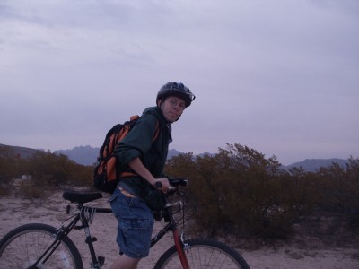 Although for many (most?) caches, I've gotten there by the amazing luck that my truck would make it, I've also gotten to caches by bike (in addition to walking- but let's not go there). A few weeks ago, I rode my bike out 4 miles (8 miles round-trip) to get a cache. I have a feeling if I had driven to the area and just walked the last 600 feet to get to the cache, it wouldn't have been nearly as rewarding. I still would have found the cache, sure- but there's just something of an accomplishment of going 8 miles to find a cache. I think by having more energy and effort that goes into doing a hobby, more is gotten from it. In this case, I was able to get out of the house, get some exercise, and get a sense of achievement. Driving doesn't really allow for that. It is necessary to do though, particularly for the more remote caches- often which are rewarding in their own right.
In May, I'll be visiting San Francisco (en route to Geowoodstock VI in Sacramento). While in the area, I'm hoping to spend one day on Angel Island. There are about 40 caches there. The best part is that I should be able to rent a bike for the day. I think riding my bike to get 40 caches in a day is an ambitious goal. Driving to those caches would still be an accomplishment- but there's just something about that extra effort. I guess because even more goes into finding those caches than just finding the caches. The bike riding is its own special accomplishment, combined with geocaching, making it all the more great. It's the same with hiking and geocaching. They just go great together.
23 April 2008
FTF: First to Finally realize there's an addiction?
In my area, I've become well known. There are many reasons for this: my kilt, the events I've thrown, some evil caches, riding my bike around, and perhaps even some of the logs I write. One other thing I'm known for: being the first to find.
I'll admit it. I'm somewhat of a FTF hound. Right now, I have about 55 first to finds out of 505 total finds - almost 11% of my finds are FTFs. Do those numbers actually mean anything? Not at all. In fact, recently I've been trying not to put so much emphasis on actually being there first. It's all entirely random who is the first to find. It's all about who has the most free time (I happen to have a very flexible schedule right now), who happens to be available at the moment, and who just happened to check their e-mail at the right time. It really is all coincidental. It doesn't matter if I find the cache first or tenth. It's still located at the same place and still ends up getting me out of the house to do something I enjoy.
I still go for FTFs, however, because I've found most of the caches in the area- except for the "trouble" caches, or ones I just haven't been able to get to for whatever reason. A new cache means I can once again go out to geocache, instead of just staying inside all day. That's my big motivation. Plus, there are some fun stories about getting there first- since you have no one's experience to base yours off of. You might get stuck because you didn't know about a certain hole in the road, or get lost because you couldn't find the turn off. There's also the fun of meeting other geocachers attempting to get a FTF. It seems more likely there will be more geocachers at a new cache than one that's been around for a while- although I have met up with cachers randomly at older caches.
I guess my overall view of a FTF is that it can be fun, and for those who have found the majority of the caches in an area, it almost becomes a necessity to continue caching- perhaps not being first to find, but certainly going after the new caches. It shouldn't be a big deal, however, since it really is almost random and circumstantial as to who actually gets to the cache first.
I'll admit it. I'm somewhat of a FTF hound. Right now, I have about 55 first to finds out of 505 total finds - almost 11% of my finds are FTFs. Do those numbers actually mean anything? Not at all. In fact, recently I've been trying not to put so much emphasis on actually being there first. It's all entirely random who is the first to find. It's all about who has the most free time (I happen to have a very flexible schedule right now), who happens to be available at the moment, and who just happened to check their e-mail at the right time. It really is all coincidental. It doesn't matter if I find the cache first or tenth. It's still located at the same place and still ends up getting me out of the house to do something I enjoy.
I still go for FTFs, however, because I've found most of the caches in the area- except for the "trouble" caches, or ones I just haven't been able to get to for whatever reason. A new cache means I can once again go out to geocache, instead of just staying inside all day. That's my big motivation. Plus, there are some fun stories about getting there first- since you have no one's experience to base yours off of. You might get stuck because you didn't know about a certain hole in the road, or get lost because you couldn't find the turn off. There's also the fun of meeting other geocachers attempting to get a FTF. It seems more likely there will be more geocachers at a new cache than one that's been around for a while- although I have met up with cachers randomly at older caches.
I guess my overall view of a FTF is that it can be fun, and for those who have found the majority of the caches in an area, it almost becomes a necessity to continue caching- perhaps not being first to find, but certainly going after the new caches. It shouldn't be a big deal, however, since it really is almost random and circumstantial as to who actually gets to the cache first.
12 April 2008
Origins: Mowhawk Mesa
 An interesting thing happened to me recently: I have in my possession the very first cache I found. I finally made it back to that "first time": Mowhawk Mesa, Crack in the Earth Cache (note it's not an "earthcache"- there's a space between the words). I even picked up a souvineer: the cache itself. As it turned out, the container has been retaining water. While it doesn't rain too much here, it does every so often. When that happens, water fills up in the container.
 It's actually a nice container with no holes in it. The lid just isn't water-sealed, and looks like it can come off easily (not to mention the fact that we found the container with the lid off).
It was nice being in the area again. It's not just that it's a really nice area (although it is- amazing) with some really cool geologic features (going through a slot canyon is quite the adventure). It's just something about that "first cache" that creates something special about the place.
I'm just glad I was able to actually replace the cache. It's in a less interesting container (a standard ammo can), but at least it won't retain water when it rains in a few months.
 Mowhawk Mesa, alone is interesting in just the way it's shaped. It's not a very big mesa (maybe 10 feet by 100 feet- max); although from one side, it is steep.
The big draw to the area is the slot canyon. A slot canyon is essentially a very narrow and deep canyon. It's probably only 5 feet wide- which means it's just barely big enough to walk through, and especially difficult if you have a backpack on or are carrying anything (like the original cache container). It's full of lots of turns, making it difficult to get through.

In these slot canyons, it's also rather dark. Just because of how deep they are (50+ feet) and how
 narrow they are, sunlight doesn't get in so well. That makes the insides of these canyons dark and (literally) cool.
There are also some drop-offs that are fun to try and get around. In the slot canyon I was in, it emptied into a bigger one. My friend and I thought long and hard about whether to try and drop down or go a long way around.
 If we did that, it'd mean going back through the slot canyon up over a few hills, and then trying to find a way into the bigger canyon... although we, at the time, didn't know if that bigger canyon would also have some drop-offs. We finally decided to do it. It was about a 10-foot drop-off to the bottom of a semi-circular ledge, followed by another 5-foot into the bigger canyon. Probably not the best idea to actually go down that. We made it out without injury, however.
Subscribe to:
Posts (Atom)

